|
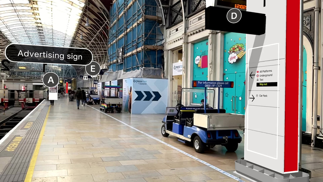
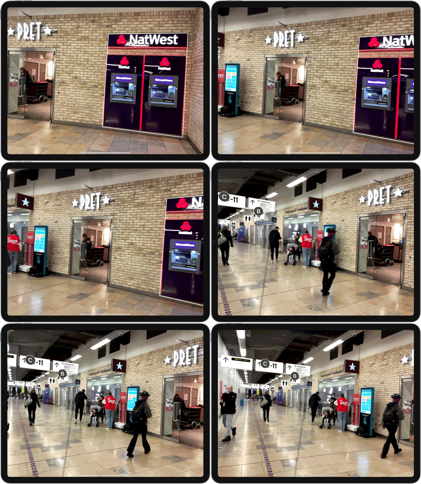
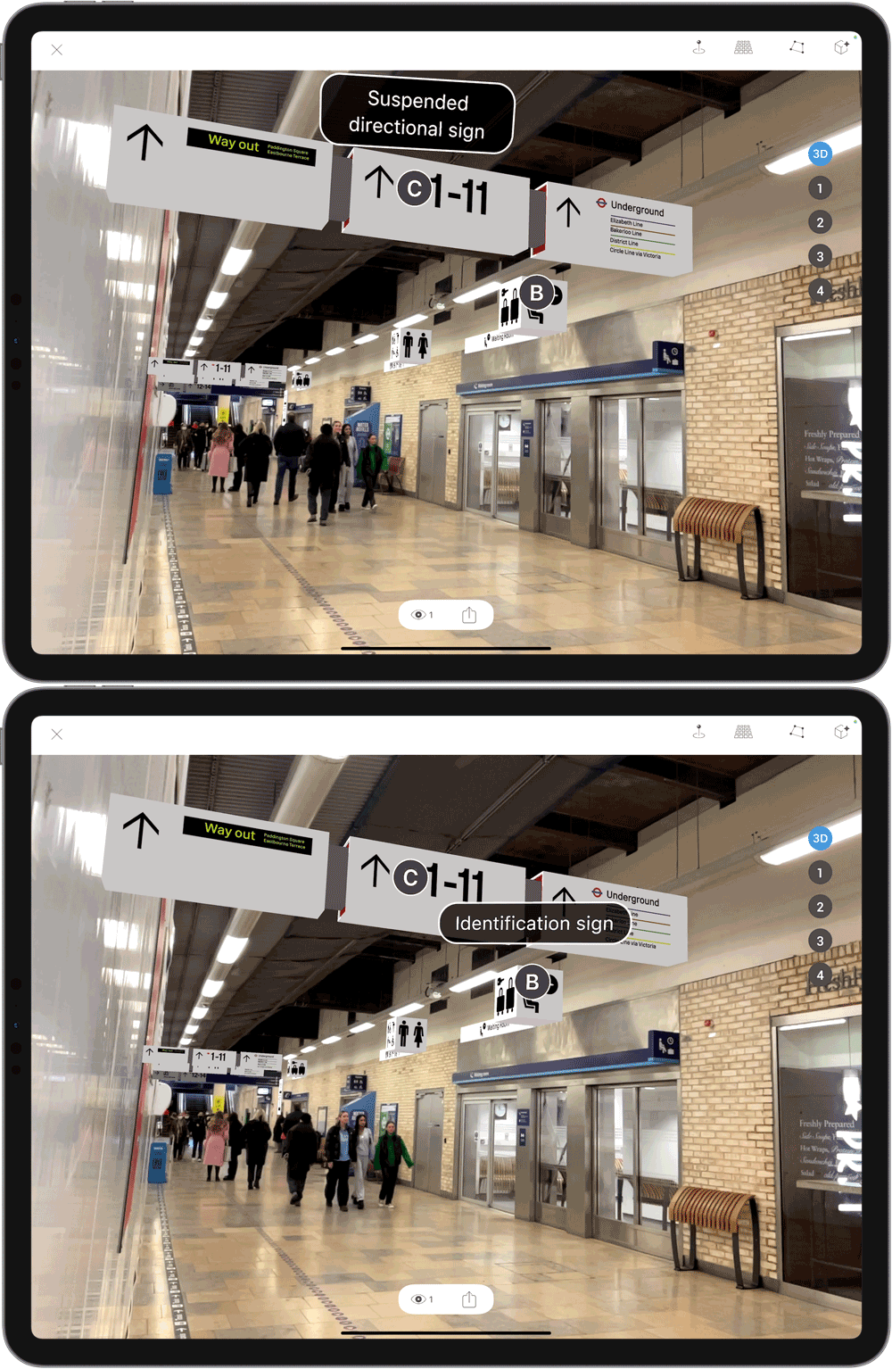
To demonstrate their new family of Wayfinding Signage designs, Network Rail use Augmented Reality to visualise their 3d models in location, allowing project teams to experience the designs at full scale. The project looks at how future stations can be easily modified, and improved, by using augmented reality as a tool for visualisation. At paddington each signage model is positioned in place using ARki app, and incorporates simple annotations to highlight design components easily. Checkout how Network Rail created a full scale Augmented Reality visualisation at Paddington using ARki below: Image AnchorThe project uses image tracking to position each model accurately in place. Multiple images within the station environment, such as advertising signs, and walls, are used to anchor the wayfinding 3D models in location. AnnotateAnnotations are used to help illustrate different way-finding models, and for tagging real-world objects in location. Inspired to create your own AR experience? ARki app is helping the next generation of designers set their work apart! If you would like to learn more about how you can be stepping into the future of Architecture + Design, click below and request a demo!
0 Comments
Your comment will be posted after it is approved.
Leave a Reply. |
Darf BlogWelcome to Darf Blog. Categories
All
Archives
March 2024
|
Want more Information?
Our TeamAbout
|
HelpTutorials
|
LegalTerms of Use
|
All works © Darf Design 2020
Please do not reproduce without the expressed written consent of Darf Design
Please do not reproduce without the expressed written consent of Darf Design


 RSS Feed
