|
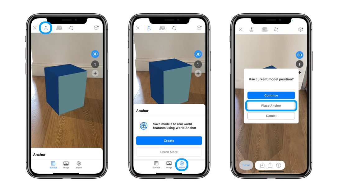
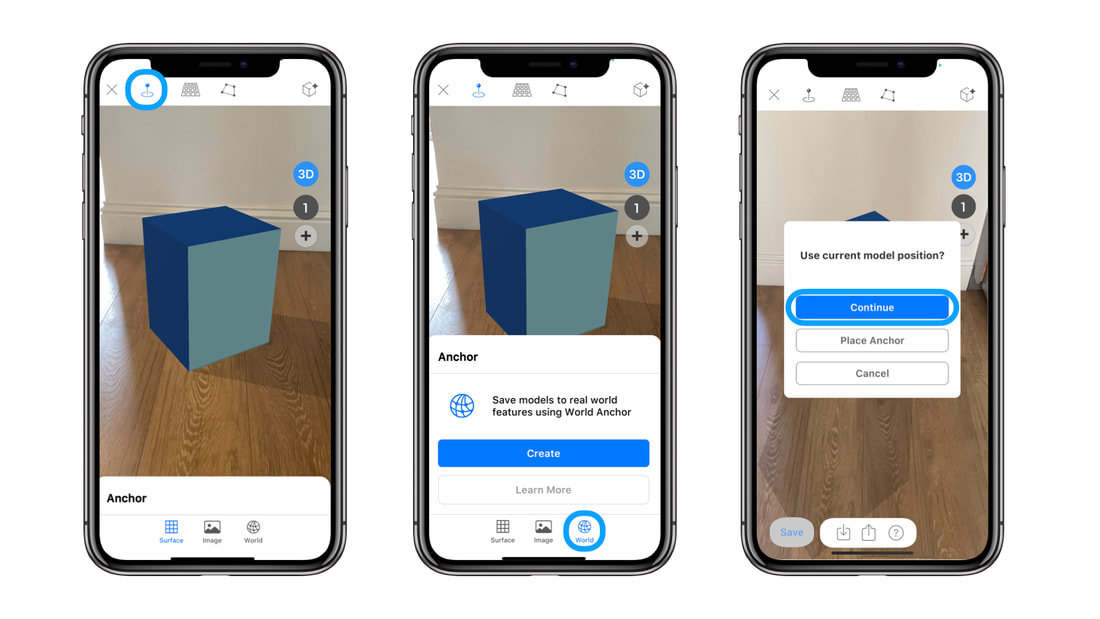
Saving AR experiences in location requires real-world anchor points, that can be used to accurately save 3d models in place. From ARki 7.4 we introduce Anchor, which allows you to choose real-world feature points that you can use as a reference for saving and sharing location-specific AR experiences. (BETA) Option A: Save Large Scale 3d models in LocationYou can save large scale models in location using World Anchor. Instructions: How to save a World anchor Import FBX model Switch to AR mode and position the model accurately in the real-world - use the transform tool for accurate placement in AR Select Anchor -> World Anchor Select Place Anchor and choose a world feature that you want to use as an anchor point Place the anchor Ui on a horizontal or vertical plane closest to the world feature Move around the anchor Ui to save 360 degree view of the feature Instructions: How to load a World anchor open the project - select AR - Anchor - World The saved world anchor image will show - press start - and scan the area which is shown in the image For best performance follow the tips below: 1:Position the model on a flat surface such as the ground/table planes. If your site does not have enough flat areas it will not be possible to have an accurate tracking performance. 2: Scan the outdoor environment or object slowly during save, to get the maximum detail and accuracy of the environment. 3: Scan and save an area that is at least 1 metre square and has enough 3d detail, so that the app can store enough feature points. 4: Use Good daylight to ensure the app can detect enough feature points. 5: We recommend using distinct elements in the world, such as roadsigns, and statues to anchor 3d models in the exact location for 1:1 viewing. Do not use grass or paving which have a similar texture over large spans as your world anchor point. 5: We recommend using a site which is not too busy with moving people/cars, as this will confuse the camera feed. *Please note: World Anchor is still in Beta, there may be limitations loading and saving models between LiDAR and non-LiDAR devices. The video shows how you can save 3d models accurately in location by using a sign as a static anchor point. The app stores features of the sign during the save process, and will load the model in relation to this anchor during load. Option B: Save 3d Models in Position using World AnchorSave AR models in position using World Anchor. The anchor tool lets you save 3d models to any static 3d object or internal environment. The video shows how to save a model in place, by using a table as a World Anchor. Instructions: Import model, Switch to AR mode and position 3d accurately Select Anchor -> World Anchor Move around the anchor to save 360 degree view of the model Instructions: How to load a World anchor open the project - select AR - Anchor - World The saved world anchor image will show - press start - and scan the area which is shown in the image For best performance, scan and save an area that is at least 1metre square and has enough 3d detail, so that the app can store enough feature points. When loading the model in place, it is important that the area that is being scanned does not differentiate from the original saved anchor. Use good lighting to ensure the app can detect enough feature points. *Please note: World Anchor is still in Beta, there may be limitations loading and saving models between LiDAR and non-LiDAR devices.
5 Comments
Jakub Pelka
16/3/2020 12:51:25 pm
Is it available only in Enterprise subscription model ?
Reply
sahar
16/3/2020 04:27:05 pm
Anchor is now available on the Pro subscription
Reply
4/9/2020 01:51:10 pm
I loved this article as it provides me lots of information regarding the anchor models in location. You will get the best review over here. It plays a vital role in taking us through. It can be really great for people like me who are looking for grabbing more knowledge about it.
Reply
arta
13/4/2021 04:08:47 pm
Hello - GPS alone will not provide much accuracy as it has usually between 1-5 metres in range. World Anchor uses actual visual feature points in the real world to store the models more accurately.
Reply
Your comment will be posted after it is approved.
Leave a Reply. |
|
Want more Information?
Our TeamAbout
|
HelpTutorials
|
LegalTerms of Use
|
All works © Darf Design 2020
Please do not reproduce without the expressed written consent of Darf Design
Please do not reproduce without the expressed written consent of Darf Design


